
Wangat is a small forested valley in Ganderbal district, approximately 85km from Srinagar -- 70km on the Srinagar-Kargil national highway to Kangan, then 15km on a mountain road into the valley. It sits at roughly 2,200m and is the western approach to Gangabal Lake. Almost no tourist itinerary includes Wangat. Ganderbal district receives fewer than 2% of J&K's total summer visitors despite holding some of the valley's most intact pine and fir forest. Via Kashmir's viakashmir.in/cabs handles the Kangan to Wangat mountain road with appropriate vehicles.
Want to visit Wangat on your Kashmir trip?
Via Kashmir's local team knows this route -- the right vehicle for the Wangat road, what to carry, and how to combine it with Sonamarg or Naranag. Enquire at viakashmir.in/cabs or viakashmir.in/enquire/general.
In This Article
Quick Answer: Wangat is a small forested valley in Ganderbal district, approximately 85km from Srinagar -- 70km on the Srinagar-Kargil national highway to Kangan, then 15km on a mountain road into the valley. It sits at roughly 2,200m. The valley is the approach route to Nundkol and Gangabal lakes. Almost no tourist itinerary includes Wangat. Ganderbal district receives fewer than 2% of J&K's total summer visitors despite holding some of the valley's most intact pine and fir forest.
The road from Srinagar to Leh passes through Kangan. Most visitors on that road are either heading to Sonamarg (22km further on from Kangan) or to Leh beyond it. Kangan itself is a small town, a fuel stop, a few dhabas, nothing to slow you down. Fifteen kilometres off the highway, on a road that climbs into the Sindh Valley tributary draining from the north, is Wangat.
The reason it does not appear on tourist maps is not that it is inaccessible or dangerous. It is simply that no one put it in the itinerary, and so no one went, and so no one put it in the itinerary.
At a Glance: Wangat Valley
| Best time to visit | Getting there | What to expect | ViaKashmir link |
|---|---|---|---|
| June through September; July and August for full forest green | Srinagar to Kangan (70km, ~90 min), then Wangat road (15km, 30-40 min) | Pine and fir forest, the Wangat stream, basic facilities in Kangan only | viakashmir.in/cabs |
Where Exactly Is Wangat?
Wangat sits in Ganderbal district, in the drainage of the Nundkol stream that flows south into the Sindh River near Kangan. The valley runs roughly north-south, with the village of Wangat at the lower end and the forest road continuing north into the mountains toward the alpine zones that hold Nundkol Lake and, further, Gangabal Lake at 3,576m.
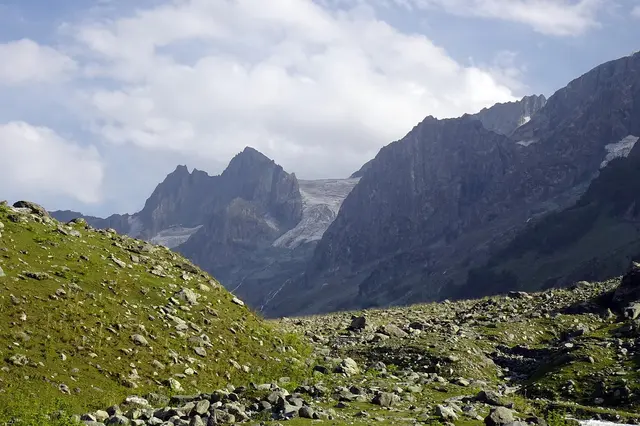
The mountains above Wangat are part of the same range that forms the back wall of the Sonamarg basin -- the Harmukh massif at 5,142m, one of the highest peaks in the Kashmir valley. From the upper sections of the Wangat road on a clear day, the southern face of Harmukh is visible -- a snow-streaked wall above the treeline. This is not the Harmukh view you get from a hotel window in Srinagar. It is closer, more specific, and has the forest between you and it.
Related reading: Srinagar's Local Bazaars: What the Markets Actually Look Like -- and What Is Worth Buying
What Makes Wangat Worth the Drive?
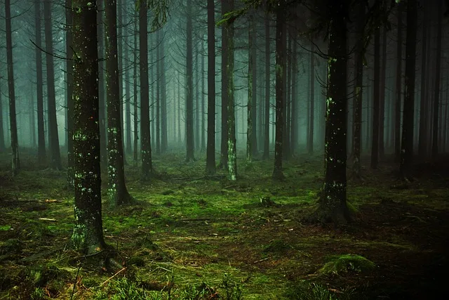
The lower and mid sections of Wangat valley are covered with dense pine and fir. Not the ornamental deodar plantings you see at roadsides in the valley -- actual old-growth forest with tall, closely-spaced trees, a thick understory of undergrowth, and a forest floor that in July is wet from the cloud and spring water. The road into Wangat passes through this forest for roughly 10km before reaching the small clearing at the upper end where the road ends and the trekking trails begin.
In July the forest is dark even at midday. The tree canopy closes over the road at points. The Wangat nallah -- the stream -- runs alongside the road for most of the approach, fast and cold from snowmelt above. The sound of it is constant. Air temperature drops 4-6 degrees C as you move from Kangan town into the forest. Kashmiri families from Srinagar and Ganderbal have been coming here for picnics for generations -- you will find them at the clearings along the stream, no souvenir stalls, no hotel signboards in the valley itself.
Is Wangat a Trekking Destination or a Day Visit?
Both. As a day visit from Sonamarg or Srinagar, Wangat works as a 5-6 hour round trip from Srinagar (drive there, spend 2 hours in the valley, drive back) or as a detour on the way to or from Sonamarg. The forest and the stream are the experience; no trekking required. As a trekking base, Wangat is the starting point for the western approach to Gangabal Lake. The Wangat-Gangabal trek takes 2-3 days (Wangat to Nundkol Lake is one day, Gangabal is the second). It is less used than the Naranag approach, which means fewer other trekkers on the trail. Via Kashmir's viakashmir.in/packages arranges guided treks on this route.
Related reading: Srinagar's Wooden Mosques: What the Old City's Sacred Architecture Actually Looks Like
Wangat vs Naranag: Two Ways to the Gangabal Basin
| Wangat Approach | Naranag Approach | |
|---|---|---|
| Starting point | Kangan, 70km from Srinagar | Naranag, 50km from Srinagar |
| Forest character | Pine and fir, dense, wet | Open pine, more sparse |
| Day 1 destination | Nundkol Lake (3,576m) | Trunkhol Lake or Nyobrar camp |
| Trek traffic | Very light | Moderate in peak season |
| Facilities at trailhead | None in Wangat; guesthouses in Kangan | Basic guesthouses in Naranag |
| Via Kashmir link | viakashmir.in/packages | viakashmir.in/packages |
Book for this trip


What to Know Before Going to Wangat
There are no hotels, restaurants, or shops in Wangat valley. Kangan town (15km below) has basic dhabas and a few guesthouses. Carry lunch and water from Srinagar or Sonamarg. The Wangat road is single-lane and unpaved in sections -- a standard car can reach the lower and mid sections (roughly 10km); the final 5km to the trekking base requires a high-clearance vehicle. Via Kashmir's viakashmir.in/cabs uses appropriate vehicles for mountain road routes. Mobile signal is sporadic from Kangan and absent in Wangat beyond the first 3-4km -- download offline maps before you go.
The Sindh Valley drive between Srinagar and Kangan is worth taking slowly even before you turn up toward Wangat -- the river runs alongside the highway for long stretches, the mountains close in on both sides, and the villages along this corridor are relatively unspoiled. Via Kashmir is the local platform for all custom Kashmir routes; viakashmir.in/packages can build Wangat into a Kashmir itinerary on request.
Frequently Asked Questions: Wangat Valley Kashmir
How do you get to Wangat from Srinagar?
Drive the Srinagar-Kargil national highway toward Sonamarg. At Kangan (70km, approximately 90 minutes), turn left (north) off the highway onto the Wangat road. The valley road continues 15km into the mountains -- 30-40 minutes by car depending on conditions. Via Kashmir's viakashmir.in/cabs handles this route with appropriate mountain road vehicles.
Is Wangat good for a day trip from Sonamarg?
Yes. Sonamarg is 22km east of Kangan on the same highway. From Sonamarg, the drive to the Wangat turnoff at Kangan takes 30-35 minutes, then 30-40 minutes up the Wangat road. A morning departure from Sonamarg allows 2-3 hours in Wangat and return to Sonamarg by early afternoon. It is one of the better alternatives to the Sonamarg meadow for visitors who want dense forest rather than open hillside.
Can you camp in Wangat valley?
The forest clearings along the Wangat stream are used for camping by trekkers approaching Gangabal Lake. There is no formal campsite but the lower clearings are established informal sites. For organised camping with guide and equipment, Via Kashmir's viakashmir.in/packages arranges Wangat-based trips.
Are there facilities in Wangat valley?
No hotels, restaurants, or shops in the valley itself. Kangan town on the main highway (15km below) has basic guesthouses and dhabas. All supplies for a Wangat visit should be carried from Srinagar or Sonamarg.
What wildlife can you see in Wangat?
The dense forest supports the typical high-altitude Kashmir wildlife zone: Himalayan monal (the brilliantly coloured pheasant), brown bear in the upper forest sections, musk deer, and numerous birds. The monal is visible at the forest edge in early morning. Brown bear are uncommon near the road but the upper valley above the trekking base should not be walked alone at dusk. Via Kashmir's viakashmir.in/packages arranges treks with local guides who know current wildlife activity.
Kashmir Pulse is Via Kashmir's editorial channel -- written by locals, not agencies.
Planning a trip to Kashmir?
Plan with Via Kashmir →Planning more than this? Get a full itemised Kashmir quote