
Quick Answer
The Manali to Leh highway: about 430 km over two days via the Atal Tunnel, Jispa, Baralacha La, Sarchu, the More Plains and Tanglang La, with opening months and altitude advice.
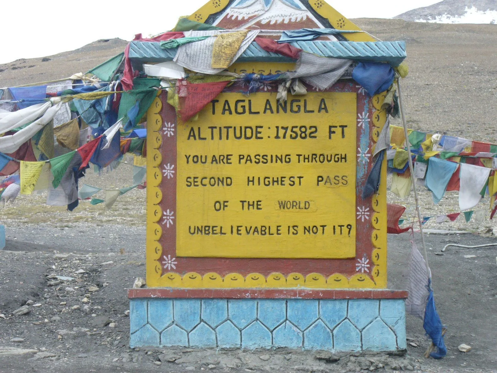
The Manali-Leh highway is one of the great mountain roads of the world, about 430 km from Manali through Lahaul to Leh. Since the Atal Tunnel opened in 2020, travellers no longer need to cross Rohtang Pass. The road then climbs over Baralacha La, crosses the high plateau of Sarchu and the More Plains, and tops out at Tanglang La before descending to the Indus at Upshi.
Quick answer
Manali to Leh is about 430 km and takes 2 days, usually with a night in Jispa (about 3,200 m) rather than Sarchu (about 4,300 m) for better acclimatisation. The road opens around June and closes by mid-October. Passes: Baralacha La (about 4,890 m), Nakee La, Lachulung La and Tanglang La (about 5,330 m).
Route and stops
| Stage | Approx. distance | Notes |
|---|---|---|
| Manali to Keylong via Atal Tunnel | About 115 km | Lahaul valley |
| Keylong to Jispa | About 22 km | Recommended night stop, about 3,200 m |
| Jispa to Baralacha La | About 50 km | High pass, about 4,890 m |
| Baralacha La to Sarchu | About 30 km | Camps, about 4,300 m |
| Sarchu to Pang via Gata Loops, Nakee La, Lachulung La | About 80 km | Pang has dhabas |
| Pang across More Plains to Tanglang La | About 60 km | Tanglang La about 5,330 m |
| Tanglang La to Upshi and Leh | About 110 km | Down to the Indus |
Jispa or Sarchu for the night?
Jispa is lower and more comfortable, which makes it the safer overnight for most people, especially families. Sarchu, at about 4,300 m, is higher than Leh; sleeping there on your first night at altitude is when many people get headaches and nausea.
Season and conditions
The road usually opens in late May or June after snow clearing and stays open until around mid-October. Monsoon rain in Lahaul can cause landslides in July and August, and water crossings rise in the afternoon. Start early each day.
Tips
- Fuel at Tandi (near Keylong) and then not until Karu or Leh; carry a spare can.
- Mobile coverage is patchy beyond Keylong.
- Carry warm layers even in July: the passes are cold and windy.
- Indian citizens register online and pay the Ladakh environment and wildlife fees before visiting protected areas such as Nubra, Pangong, Tso Moriri, Hanle and Turtuk; foreign nationals need a Protected Area Permit through a registered agent. Rules and fees change, so check our permits guide before you travel.
Frequently Asked Questions
How far is Leh from Manali by road?
About 430 km, usually driven over 2 days.
When is the Manali-Leh highway open?
Roughly from June to mid-October, depending on snow.
Is it better to stay in Jispa or Sarchu?
Jispa, because it is much lower (about 3,200 m vs 4,300 m), which is safer for acclimatisation.
What is the highest pass on the Manali-Leh road?
Tanglang La, at about 5,330 m.
Written by Via Kashmir Editorial Team
Last checked 2026
Via Kashmir is a Srinagar-based travel company built around one goal: giving travellers the best possible Kashmir experience. Our team puts together the best-priced hotels, cabs, Kashmir tour packages, and adventure packages with real sports activities, drawing on daily, on-the-ground knowledge of Kashmir's roads, weather, and seasons. Every guide on this site is written and checked by our local Srinagar team.