
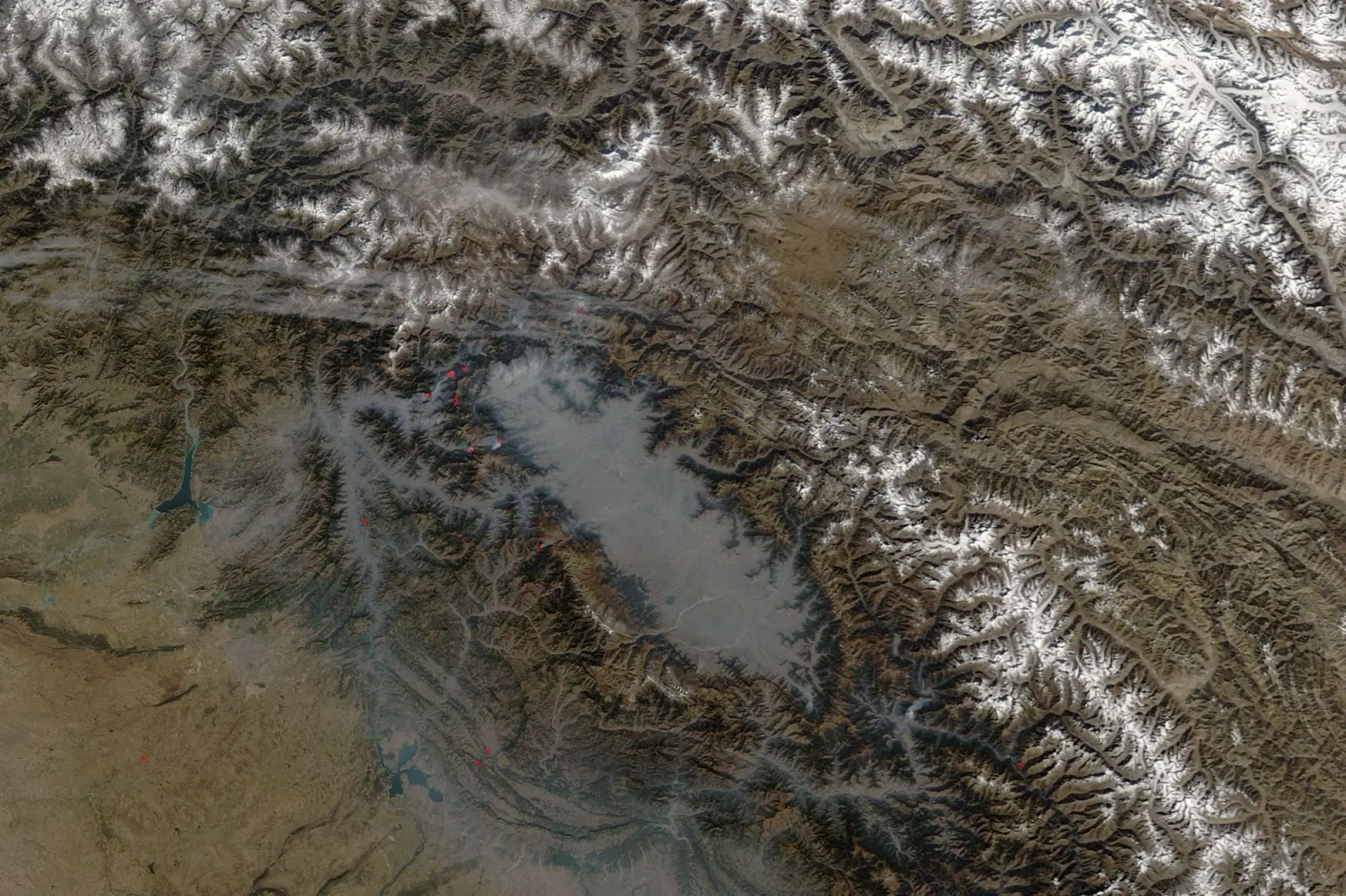
Distance, drive time and altitude from Srinagar to 22 Kashmir tourist places in one table, which ones work as day trips, which need a night, and how to group them by direction so you never drive the same road twice.
Want these places in the right order?
Tell us your days and the places on your list. We group them by direction and send a route with drive times and a price.
In This Article
- Distance from Srinagar to every main tourist place
- Which places are day trips from Srinagar?
- Group places by direction, not by fame
- Distances inside Srinagar
- Sample routes using these distances
- Which roads close in winter?
- How long does it take to drive between the main towns?
- How do altitudes change what you pack?
- What does a cab cost for these distances?
- Frequently asked questions
Srinagar sits in the middle of the Kashmir Valley, and almost every trip uses it as the hub. That makes distance from Srinagar the single most useful number when you plan: it tells you what can be a day trip, what needs a night, and which places sit on the same road. The table below gives road distance, a realistic drive time without long stops, and the altitude of each place, so you know what to pack and who in your group might feel it.
Distance from Srinagar to every main tourist place
| Place | Road distance | Drive time | Altitude | Direction | Best as |
|---|---|---|---|---|---|
| Pampore (saffron fields) | 15 km | 30 min | About 1,600 m | South, on the Pahalgam road | Stop on the way |
| Dachigam National Park | 22 km | 45 min | 1,700 m and up | East | Half day |
| Awantipora ruins | 29 km | 45 min | About 1,600 m | South, on the Pahalgam road | Stop on the way |
| Manasbal Lake | 30 km | 1 hr | About 1,580 m | North | Half day |
| Tangmarg | 38 km | 1 hr 15 min | About 2,200 m | West, below Gulmarg | Stop on the way |
| Doodhpathri | 42 km | 1 hr 30 min | About 2,730 m | South-west | Day trip |
| Yusmarg | 47 km | 1 hr 30 min | About 2,400 m | South-west | Day trip |
| Gulmarg | 50 km | 1 hr 30 min | About 2,650 m | West | Day trip or 1 to 2 nights |
| Naranag | 50 km | 1 hr 45 min | About 2,130 m | North-east, via Kangan | Day trip |
| Achabal Garden | 58 km | 1 hr 45 min | About 1,680 m | South | With Kokernag |
| Verinag | 78 km | 2 hr 15 min | About 1,880 m | South | With Kokernag |
| Sonamarg | 80 km | 2 hr 30 min | About 2,800 m | North-east | Day trip or 1 night |
| Kokernag | 80 km | 2 hr 15 min | About 2,000 m | South | Day trip |
| Pahalgam | 90 km | 2 hr 30 min | About 2,130 m | South-east | 2 nights |
| Betaab Valley | 105 km (15 km past Pahalgam) | 3 hr | About 2,400 m | South-east | From Pahalgam |
| Aru Valley | 102 km (12 km past Pahalgam) | 3 hr | About 2,410 m | South-east | From Pahalgam |
| Chandanwari | 106 km (16 km past Pahalgam) | 3 hr 15 min | About 2,895 m | South-east | From Pahalgam |
| Gurez Valley | About 140 km | 5 to 6 hr | About 2,400 m | North, over Razdan Pass | 2 to 3 nights |
| Sinthan Top | About 130 km | 4 hr | About 3,750 m | South-east, via Kokernag | Long day (summer only) |
| Kargil | About 200 km | 6 to 7 hr | About 2,680 m | East, over Zoji La | On the way to Leh |
| Jammu | About 260 to 270 km | 7 to 9 hr | About 330 m | South, by NH44 | Travel day |
| Leh | About 420 km | 12 hr, usually split at Kargil | About 3,500 m | East, over Zoji La | 2-day drive |
Distances are approximate road distances from central Srinagar (Dalgate), and the same figures our drivers use for cab fares. Drive times assume normal traffic and good weather. In winter, add time for snow on the Gulmarg and Sonamarg roads, and note that Gurez, Sinthan Top and the Mughal Road close for months.
Which places are day trips from Srinagar?
Anything up to about 80 km and two and a half hours each way works as a day trip, as long as you leave by 8 am. That covers Gulmarg, Sonamarg, Doodhpathri, Yusmarg, Manasbal, Naranag and the South Kashmir springs (Achabal, Kokernag and Verinag together). Pahalgam is technically a day trip too, but the valleys beyond it (Betaab, Aru and Chandanwari) need the local union taxi and a full day of their own, so two nights there is far better.
Group places by direction, not by fame
The most common mistake we see is a route that zig-zags: Gulmarg on day 2, Pahalgam on day 3, back to Gulmarg area for Doodhpathri on day 4. These places sit in different directions from Srinagar, so plan by road:
| Direction from Srinagar | Places on that road | How to plan it |
|---|---|---|
| West | Tangmarg, Gulmarg, Drung, Khilanmarg | One day trip or one night in Gulmarg |
| South-west | Doodhpathri, Yusmarg | One day each, or both on separate days |
| North-east (Sindh valley) | Manasbal (slight detour), Kangan, Naranag, Sonamarg, Zero Point | Sonamarg as a full day; Naranag as its own day |
| South and south-east | Pampore, Awantipora, Achabal, Kokernag, Verinag, Pahalgam | Stop at Pampore and Awantipora on the way to Pahalgam |
| Far north | Gurez, Bangus, Lolab | Separate trips of 2 nights or more |
Distances inside Srinagar
Measured from Dalgate, at the southern end of Dal Lake, where most visitors stay.
| Place | Distance from Dalgate | Time by car |
|---|---|---|
| Shankaracharya Temple | About 5 km | 20 min |
| Hari Parbat | About 5 km | 20 min |
| Jamia Masjid and the old city | About 5 km | 20 to 30 min |
| Indira Gandhi Tulip Garden | About 8 km | 20 min |
| Chashme Shahi | About 9 km | 25 min |
| Hazratbal | About 10 km | 30 min |
| Nishat Bagh | About 11 km | 30 min |
| Pari Mahal | About 11 km | 30 min |
| Srinagar airport | About 14 km | 30 to 45 min |
| Shalimar Bagh | About 15 km | 40 min |
The Mughal gardens sit in a line along the east shore of Dal Lake: Chashme Shahi, Nishat and Shalimar can be covered in one morning, with Pari Mahal on the way to Chashme Shahi. Our top places to visit in Srinagar guide has timings and tickets.
Related reading: Kashmir Trip with Elderly Parents: An Easy-Pace Plan That Works
Sample routes using these distances
| Trip length | Route | Total driving |
|---|---|---|
| 3 days | Srinagar 1 night, Gulmarg day trip, Srinagar; or Srinagar and Pahalgam | About 200 km |
| 5 days | Srinagar 2 nights (Gulmarg day trip), Pahalgam 2 nights, back to Srinagar | About 330 km |
| 7 days | Srinagar 3 nights (Gulmarg and Sonamarg day trips), Pahalgam 2 nights, Srinagar 1 night | About 500 km |
| 10 days | The 7-day route plus Doodhpathri, Yusmarg and the South Kashmir springs | About 750 km |
These follow the direction rule above. For ready plans see our 7-day Kashmir itinerary.
Which roads close in winter?
| Road | Usual status in winter | Typical opening |
|---|---|---|
| Srinagar to Gulmarg | Open; Tangmarg to Gulmarg may need 4x4 and chains after snow | All year |
| Srinagar to Pahalgam | Open; snow in Pahalgam town | All year |
| Srinagar to Sonamarg | Open through the Z-Morh tunnel, subject to weather | All year since 2025 |
| Zoji La (to Kargil and Leh) | Closed | Around April to May |
| Razdan Pass (to Gurez) | Closed | Around May |
| Mughal Road and Sinthan Top | Closed | Around April to June |
| Jammu to Srinagar (NH44) | Open, with closures after heavy snow or landslides | All year |
How long does it take to drive between the main towns?
| Route | Approx. distance | Drive time |
|---|---|---|
| Gulmarg to Pahalgam | About 140 km via Srinagar | 4 to 4.5 hours |
| Gulmarg to Sonamarg | About 130 km via Srinagar | 4 hours |
| Pahalgam to Sonamarg | About 170 km via Srinagar | 5 hours |
| Srinagar airport to Dal Lake | About 14 km | 30 to 45 minutes |
There is no direct road between Gulmarg, Pahalgam and Sonamarg; every transfer passes through or near Srinagar. That is why a Srinagar base with day trips often beats moving hotels every night.
How do altitudes change what you pack?
Srinagar sits at about 1,585 m. The meadows (Gulmarg, Sonamarg, Doodhpathri) are 1,000 to 1,200 m higher, which makes them 6 to 8 degrees colder on the same day. Gondola Phase 2 and Zero Point beyond Sonamarg are above 3,500 m, where even summer afternoons call for a warm jacket. Carry one more layer than Srinagar's weather suggests on every mountain day.
Book for this trip


What does a cab cost for these distances?
We sell fixed fares for the main routes, including Srinagar to Gulmarg, Pahalgam, Sonamarg and Doodhpathri. Each page shows the live fare by vehicle (sedan, Innova, Crysta, Tempo Traveller) with 5% GST shown separately. In Pahalgam and Sonamarg, the local union taxis to the side valleys are a separate fixed charge paid to the operator.
Send us your list of places and the number of days. We will return a route grouped by direction, with drive times, hotels and an itemised price.
Get a route plan →Frequently asked questions
What is the distance from Srinagar to Gulmarg?
About 50 km by road via Tangmarg, around 1.5 hours in normal conditions. In heavy snow the last stretch from Tangmarg may need a 4x4 with chains, which adds time.
What is the distance from Srinagar to Pahalgam?
About 90 km via Pampore, Awantipora and Anantnag, around 2.5 to 3 hours. Betaab Valley, Aru and Chandanwari are 12 to 16 km beyond Pahalgam town.
What is the distance from Srinagar to Sonamarg?
About 80 km along the Sindh valley via Kangan, around 2.5 hours. Zero Point, beyond Zoji La, is a further drive and usually needs a local taxi.
Which tourist places are closest to Srinagar?
Inside the city: Dal Lake, the Mughal gardens, Hazratbal and the old city. Within an hour: Pampore, Dachigam, Awantipora and Manasbal Lake.
Can I see Gulmarg, Sonamarg and Pahalgam in one day?
No. They lie in three different directions from Srinagar and together add up to more than 400 km of driving. Give each its own day at least.
How far is Gurez from Srinagar?
About 140 km over the Razdan Pass, a 5 to 6 hour drive, open roughly from May to October. Plan two or three nights.
How far is Srinagar airport from Dal Lake?
About 14 km, 30 to 45 minutes depending on traffic. See our Srinagar airport taxi page for fixed fares.
How far is Doodhpathri from Srinagar?
About 42 km, around 1.5 hours by road through Budgam. It is one of the easiest day trips from the city.
How far is Yusmarg from Srinagar?
About 47 km, around 1.5 hours via Budgam and Charar-i-Sharif.
How many km is Kashmir tour in total?
A typical 5 to 7 day trip covering Srinagar, Gulmarg, Pahalgam and Sonamarg adds up to about 330 to 500 km of driving, depending on whether you base yourself in Srinagar.
How far is Leh from Srinagar by road?
About 420 km over Zoji La, usually split into two days with a night in Kargil. The road is open roughly from May to November.
Planning more than this? Get a full itemised Kashmir quote